

Feb 07, 2024
A new detailed analysis from the Rideau Valley Conservation Authority (RVCA) has found many parts of the Rideau River Watershed are changing fast – and not always with positive results.
The RVCA’s 193-page Watershed Conditions Report is the first of its kind in more than 50 years. It compiles recent and historical monitoring data to assess trends regarding surface and ground water quality, aquatic ecosystem health, hydrological function, natural hazard risks and the status of critical green infrastructure such as wetlands, forests and natural shorelines.
“This document will provide invaluable insights for the RVCA and its partners as we continue to strive for balance between conserving our natural resources and helping build safe and thriving communities,” said RVCA General Manager Sommer Casgrain-Robertson.
“The issues identified here do not come as a surprise, but now we have data and analysis that will allow us to take targeted action and make measurable improvements for the benefit of all.”
Completion of the conditions report is the first step in the development of a Watershed Management Strategy, which aims to identify areas of concern and then create a strategy to address them. This process will include public consultation later in 2024.
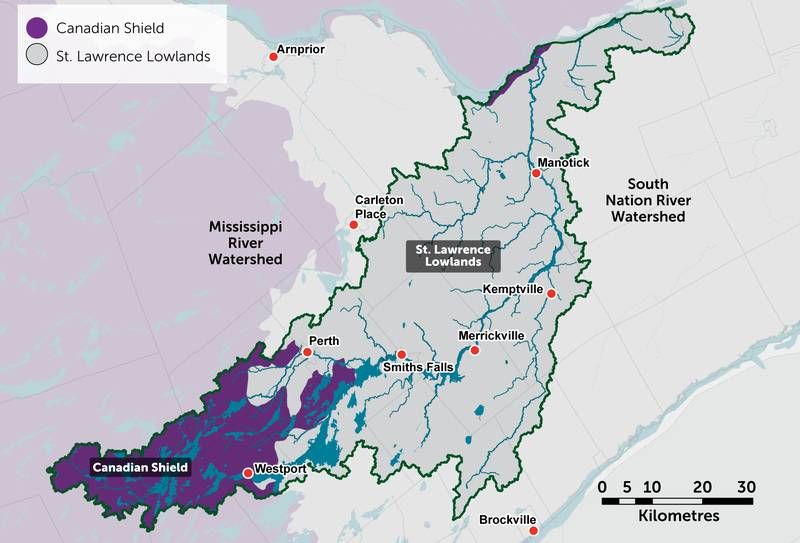
The diverse Rideau Valley Watershed extends from the Canadian Shield landscape in Central and South Frontenac (Bobs and Crow Lake, Eagle Lake, and Long Lake) through a variety of landscapes and communities in Lanark and Leeds Grenville County and points east along the Rideau River to the City of Ottawa, passing through Westport, Smiths Falls, Perth, Merrickville, Kemptville, and Manotick along the way.

The report identifies water and landscape issues stemming from high density development in the more population sections of the watershed, but also looks at the impacts of seasonal development on the lakes within the upper Rideau system in the Algonquin Highland sections of the watershed.
The Rideau Valley Watershed in Frontenac County is flanked by the Cataraqui Watershed to the south, the Mississippi Watershed to the north, and the Quinte Watershed to the west.
“We look forward to partnering with First Nations, our member municipalities, partners, stakeholders and the public to develop a strategy that promotes prosperity and health for the entire watershed for generations to come,” Casgrain-Robertson said.
The complete Watershed Conditions Report can be accessed online at www.rvca.ca/conditions-report.
To learn more about the conditions report or to receive notifications about upcoming public consultation proceedings, contact This email address is being protected from spambots. You need JavaScript enabled to view it..
More Stories
- Wildfire in the 1000 block of Rutledge Road - Township Says Fire Now "Under Control"
- Verona and Sydenham Ballpayers Win National Championship With Kingston Colts
- Sweet Music and Some hard Truths At Blue Skies MusicFestival
- Building a Medical Service in Sharbot Lake
- The Local Brewing Scene – Kick and Push Continues to Grow
- Parham Fair Celebrates 133 Years Ion Spite of Setback
- Seventh Town to play Sharbot Lake As Part of Mini-Tour
- Repair Plan For Micro-Fit In North Frontenac
- September Closures for Northbrook And Sharbot Lake Beer Stores
- This "Doc Is Not In Anymore" After 54 Years
